Types of geographic information. Sources of Geographic Information
For a long time, people have been interested in what lies beyond the horizon - new territories or the edge of the earth. Centuries passed, civilization accumulated knowledge. The time had come when scientists who had never been to distant lands knew a lot about them. Sources of geographic information helped them in this.
This article will tell you what they are, as well as their varieties.
General concepts
As you might guess, this is the name of all of which a person can obtain the information he is interested in. What sources of geographic information does 5th grade (in secondary school) consider? Let's list them:
- All geographical maps, atlases, as well as various topographic plans, including military ones.
- Various geographical descriptions of a specific area.
- Directories, encyclopedic articles, results and reports of various expeditions.
- Aerial photographs and space
- and GPS/GLONASS.
These are the sources of geographic information that 5th graders in an average secondary school know. We will try to consider the characteristics of some of them in a little more detail.
Modern technologies
In recent years, more and more sources have been converted from paper to digital form. And this is not surprising. Almost all 5 sources of geographic information that we just talked about can now be found in digital form. Even professional scientists in recent years have preferred to work with digital data.

It is much more convenient to work with the same GIS system than with a pile of books. Now let's discuss some sources of geographic information in more detail.
Cards
A map is a schematic generalized image of the surface of a certain area of the earth, the entire planet or celestial bodies. It is built on the principle of scaling, that is, mathematical methods are used for this. Depending on the scale, all maps are usually divided into three large groups:
- Large scale.
- Medium-scale.
- Small scale.
If we talk about the first category, then the ratio of these documents can be 1:200,000 or larger. This includes almost all topographic plans. All maps with a ratio of less than 1:1,000,000 are considered small-scale. A typical geographic atlas includes either small-scale or medium-scale plans, which are best suited for studying a particular area.
Sorting map information
You should know that long before creating a map, experts make a strict selection of what will be depicted on it. This process is called as follows: cartographic generalization. Naturally, the most stringent selection exists for small-scale maps, since they need to contain the maximum amount of useful information with the minimum occupied document area. In the generalization itself, the direct purpose of the card, as well as the wishes of its customer, play an extremely important role.
Site plans

This is the name for terrain drawings that are made on a large scale (1:5000 or more), and are drawn using special symbols. In this way they resemble a school geographical atlas. The construction of such plans is carried out on the basis of visual, instrumental measurements, aerial photography, or a combined method.
Since the plans indicate relatively small areas of the earth's surface, when creating them, the curvature of the planet can be neglected. It should be clearly understood that these sources of geographic information that we have just described are fundamentally different from each other.
The main differences between plans and maps
- A centimeter of plan rarely contains more than five real kilometers on the ground. They are much more detailed than maps, in one millimeter of which hundreds of kilometers of the earth’s surface can be laid out.
- All objects on the ground are depicted in the plans in as much detail as possible. In principle, all more or less significant areas are marked on the average drawing. Thus, on the topographic plans of the General Staff of the Armed Forces of the Russian Federation (and the USSR, of course), even trees and small streams can be displayed. It is impossible to fit all this information onto maps. Actually, this is why the generalization that we talked about above is carried out. Even the exact outlines of the continents cannot be displayed on many maps, and therefore they are often plotted with significant distortions. In addition, the additional geography literature described above uses out-of-scale conventions.
- Let us emphasize once again that when constructing a plan, the curvature of the earth’s surface is neglected. Maps, especially on a small scale, must take this into account.
- There is never a degree grid on plans. At the same time, there are parallels and meridians on each of them.
- The plan is always easy to navigate. The top of the document is north, the bottom, respectively, is south. On maps, the direction is determined by parallels.
Methods of depicting objects on plans and maps

Conventional signs in this case are generally accepted options in which the characteristics of the objects depicted on the map or plan are encoded. With their help, you can display both something concrete (a mountain, for example), and something completely abstract, conditional (population density in a city, village, etc.). Of course, they all make life much easier for a person who knows the basics of cartography and knows how to read these drawings.
How long does the card remain valid?
Almost all geographers and geologists ask this question at least once in a while. The specific answer to it depends on the purpose, scale, and author of the plan. Thus, medieval researchers often drew maps literally “on their knees,” so there is no need to talk about their accuracy. But the maps of the General Staff, despite the time, are still amazing in their accuracy.
Do not forget that the maps are characterized by fairly high stability, while the plans of the Amazon and the Nile can be safely thrown away fifty years after their publication. These rivers change the topography of the Earth’s surface so effectively and quickly that older documents are only useful from a historical perspective.
Geographical descriptions, discoveries
All sources of geographic information discussed above are somewhat dry and uninteresting. It is much more interesting to read a description of a region, locality, or even a continent, written by the person who discovered it all!
Jokes aside, but descriptions and reports on geographical (geodetic, biological) studies can sometimes provide much more information than the most detailed topographic plan of the area. Moreover, the latter does not reflect some unpleasant features of a particular area (malaria, which is found in some central regions of Africa at every turn, for example).
The list of literature on geography that students are given at school (for example, Nikolina V.V. Geography, Lesson developments; Samkova V.A. We are studying the forest; Forest Encyclopedia: in 2 volumes / chief editor G.I. Vorobyov ), in fact, was formed thanks to the works of researchers who at one time recorded all this information on a map, being in the thick of things.
Brief information about the discovery of Africa
Let's tell you a little about the history of the discovery of the Dark Continent. Of course, the word “discovery” is not entirely correct here: Australia - yes, I had to suffer with it. In the case of Africa, the coastal areas where they caught black slaves and bought ivory from Arab traders were well explored, but almost no one knew what was going on in the depths of the continent.
Everything changed in the 19th century, when the legendary man arrived in Africa. It was to him that the honor of discovering the sources of the Nile and the magnificent Lake Victoria belongs. Few people know, but at one time the Russian scientist V.V. Junker (in 1876-1886) was engaged in the research of Central Africa.
For the indigenous population of the mainland, all this ended sadly: the main sources of geographical information (that is, maps), the data for which all these brave scientists collected with such difficulty and constant danger to their lives, began to be actively used by slave traders...
So, we are actually done with maps and plans. Geographic atlases fall into the same category. What is the role of modern sources of geographic information? To answer this question, let’s consider the principle of sharing old paper maps and a navigator, which is now actively used even by professional geographers and geologists.
GPS/GLONASS + maps

It should be noted that this method is excellent for determining the accuracy of maps, atlases and topographic plans. In addition, this technique satisfies the needs of historians, since they can see with their own eyes how much the area has changed, which is described in historical chronicles by contemporaries of certain events. However, literature on geography often contains plans of the area that have not been updated since the beginning of the last century.
To use such an accurate, but rather labor-intensive and somewhat extravagant method, you will have to perform three references (three different maps) to the same area of the terrain:
- First, find a more or less modern map or topographic plan.
- It is advisable to have with you a recent aerospace photograph of the area under study with a topographic reference to the coordinate system.
- Finally, you need the card whose information you are going to check.
The point of this operation is to enter all three of these terrain drawings into the navigator’s memory. Modern models of such devices have a fairly powerful processor and an impressive amount of RAM, so you can switch between cards instantly.
Determining the route
It is best to plot your route using a modern map or topographic plan. We do not recommend using old documents for this. It is quite possible that in place of the swamp there is now a passable area, but you will no longer be able to walk along the edge of the once rare young forest, since the geography of the area has radically changed. A map is good, but in most cases such documents are not very accurate.
Why are aerial photography and satellite imagery preferable to maps?
But why are paper drawings so inferior to modern technology products? This is due to the following two reasons:
- Firstly, the relevance of space photography or aerial photography in most cases is much higher. When else will cartographers be able to carry out the next generalization of new data and release up-to-date terrain plans?
- In the pictures you can literally determine the characteristics of a particular area in real time. On a map or even a topographical plan, the tree species in the forest will be displayed only schematically and only in general order. Simply put, stumbling upon a thick spruce forest in the middle of a birch forest is quite possible, but in a dense coniferous forest it is much easier to get lost.
After choosing a route and checking the new photographs, it is recommended to refer to the old map. Why such difficulties? Imagine that you are a biologist in the field. You need to determine how much the forest has grown, what new tree species have appeared, how many types of forest have changed over all these years. The ideal solution to all of these problems is to simply overlay the new map onto its old counterpart. Thus, everything becomes visible as clearly as possible.

These are the sources geography uses. The map is perhaps the most important of them, but we should not forget that over the past decades science and technology have made huge strides forward, and therefore it would be stupid not to take advantage of all modern achievements.
Conclusion
So you have found out which sources of geographic information are currently the most relevant. Oddly enough, we still use all the same plans and maps that were invented before our era. Of course, adjusted for their modern appearance.
The following sources of geographic information are distinguished.
1. Geographic information systems (GIS). GIS are computer-generated “archives” of geographic knowledge about territorial organization and the interaction of society and nature. The GIS includes:
COMPUTER;
software;
spatial information in the form of cartographic data about natural components, farms, lands, roads, etc.
The functioning of the GIS is carried out in the following sequence:
collection and automated processing of geographic information;
spatial reference of geographic information and its presentation in the form of an electronic map on the display screen;
transferring this map, if necessary, into paper form (for example, creating atlases).
An important component of GIS is aerospace information, data from aerovisual observations, ground sensors, etc.
The Institute of Geography of NASU is developing a multi-purpose National GIS of Ukraine, the purpose of which is to create a geographical-cybernetic model of the country.
2. Geographical research:
field studies;
trips;
local history excursions
tourism, mountaineering.
Field research can be expeditionary or stationary. Expeditionary studies include the study of individual natural components, sectors of the economy, etc. Natural and economic complexes are learned in the process of comprehensive geographical research (natural-geographical, landscape, economic-geographical, etc.). Expeditionary research is divided into three periods:
preparatory;
field expeditionary;
cameral (processing collected materials, writing a report, drawing up maps).
During expeditionary research, aerospace photographs of the earth's surface are used. They are decrypted, i.e. recognize objects reflected on them by their shape, color, and tone of the image.
Artificial satellites provide the opportunity to study the dynamics and periodicity of natural processes, unique phenomena and objects (volcanic eruptions, fires, avalanches, landslides, crustal faults, atmospheric pollution, etc.).
In 1995, the first Ukrainian satellite “Sich-1” was launched, equipped with instruments for remote exploration of the Earth, inventory and assessment of land, mineral exploration, meteorological forecasting, and environmental monitoring. In Ukraine there are the Center for Aerospace Research of the Earth, the Center for Radiophysical Sounding of the Earth, and the Marine Hydrophysical Institute.
Nowadays, geographic information is obtained about natural and man-made processes, changes in the natural environment, geochemical anomalies, cities and suburban areas, air pollution, flooding, the state of vegetation, areas of radioactive contamination, emissions from wastewater treatment plants.
Stationary geographical research has been carried out regularly for many years at specially equipped geographical stations. They study in detail changes in natural complexes over time. Stationary geographical research is carried out at the Institute of Geography of the National Academy of Sciences of Ukraine, Kyiv, Lvov, Odessa, Kharkov and Tauride universities.
Ukraine is a member of the World Weather Watch, the World Meteorological Organization. Hydrometeorological conditions are important economic and social factors: the social and economic state of the state, the environmental situation, the agro-industrial complex, energy, transport, utilities, and military security depend on them.
3. Sources of geographic information are local history studies and descriptions of the native land, cities and other settlements. These also include descriptions of travel, hiking and mountaineering routes, and excursions.
4. Important sources of geographic information are maps and atlases. Cartographic images reproduce the dimensions and properties of geographical objects using geographical means and signs (lines, shapes), as well as color tone. Combinations of geographical signs and background are means of cartographic modeling, creating cartographic images (geographic images). To understand the natural and economic objects displayed on the map, the components of natural conditions, processes, as well as the patterns of their distribution, legends are attached to the maps. The text of the legend, geographical names, terms and concepts allow you to “read” the map and use it.
Maps are the most important components of the information structural blocks of geographical atlases. National atlases are acquiring exceptional importance. According to the Decree of the President of Ukraine dated 08/01/2000 “On the National Atlas of Ukraine”, an atlas is being created that will reflect the spatial characteristics of natural conditions and resources, population, economy, environmental conditions, science and culture of Ukraine.
Geographic information is produced by:
Institute of Geography;
Institute of Geological Sciences;
Institute of Botany;
Institute of Zoology;
Council for the Study of the Productive Forces of Ukraine;
regional natural science and socio-economic divisions of the National Academy of Sciences of Ukraine.
5. A variety of geographical information is stored by the National Natural Museum of Ukraine, regional, district, and city local history museums.
6. A variety of geographical information is available in textbooks, manuals, statistical reference books, dictionaries, encyclopedias, scientific journals, and periodicals. The media are filled with geographic information: newspapers, radio and television programs. Geographic popular science, documentaries, and educational films are created. Geographical information can be found in fiction, paintings, landscape architecture, etc. The Internet provides great opportunities for obtaining and using up-to-date geographic information.
Sources of information include textbooks, gazetteers and encyclopedias, maps and atlases. Information-rich geographic magazines and newspapers.
Many new, useful and interesting things can be learned from radio and television programs: weather forecasts, reports of natural phenomena, natural wonders, the culture of the population of different countries, etc. Nowadays, to obtain the necessary geographical knowledge, they use the services of the Internet - the worldwide computer network. With its help, you can exchange geographic information - cartographic, text, video, audio - in a matter of minutes.
To obtain geographical information and knowledge, various research methods are used. The oldest is the descriptive research method. It consists of describing the object (where it is located, how it has changed over time, how it affects other objects, etc.). The description is carried out on the basis of observations of phenomena and processes. This method is still one of the main ones. The expeditionary method is also ancient. The word "Expedition" means "campaign". An expedition is a business trip of a group of people to study certain objects or phenomena. The material collected during expeditions forms the basis of geography. Based on it, science develops.
The historical method allows us to find out how objects and phenomena arose and developed over time. The literary method consists of studying literature - everything that has already been written on a given topic. The cartographic research method consists of determining the location of objects and plotting them on a map. By skillfully reading geographic maps, a researcher can obtain a lot of necessary information. New methods include aerospace - Studying the Earth's surface using images from aircraft and spacecraft. Using the modeling method, using computer technology, changes in the environment are envisaged.
Globe. Photo: Eamon Curry
Primary sources of knowledge
The primary sources of socio-geographical knowledge are associated with socio-geographical field research, when objects are studied directly on the ground through direct acquaintance with them, through observations, instrumental measurements, as well as interviews, questionnaires, etc. This is usually a study of individual farms and enterprises (agricultural, industrial, construction, recreational, etc.), as well as settlements and places of concentration of production and infrastructure (a set of structures and services that ensure the functioning of industries and the living conditions of society).
The primary source of socio-geographical knowledge can also be field special (thematic) mapping of the territory under study - the actual use of land, population settlement, levels of technogenic load on the territory, its ecological state, etc. For the needs of such mapping, topographic maps are usually used as a basis or plans for land use or land economic structure of administrative-territorial units, individual farms, cities.
Primary sources usually provide socio-geographical knowledge about one’s own state, since it is not often that researchers are given the opportunity to carry out the necessary field research abroad. Therefore, the main sources of socio-geographic knowledge about the world are secondary sources. Secondary sources of socio-geographical knowledge are those that were obtained and organized in a certain way by other researchers. A classic example is various literary sources - historical, geographical, environmental literature.
Now, thanks to the Internet, it is possible to “visit” the largest libraries in the world without leaving home. Among such institutions are the Library of Congress CELA, the German National Economic Library, the Russian National Library, the National Library of Ukraine. IN AND. Vernadsky similar.
To acquire knowledge in the field of social and economic geography, various sources containing organized statistical information are very important. In Ukraine, such sources are government bodies - regional and district state administrations, as well as state management structures - environmental safety and natural resources, sanitary and epidemiological service, water management, forestry, railway and water transport, electricity and gas supply, etc. Important geographic data is often also available from local authorities. Individual enterprises, farms, institutions with their operational accounting and reporting statistical information often turn out to be useful.
Are research and design institutions and organizations that accumulate stock information and scientific information also useful? design developments according to your profile. Public organizations and movements - ethnocultural, religious, political (party), professional, etc. can also have interesting socio-geographical information.
Regarding information about different states, regions or the world in general, it is available on the websites of the United Nations, the World Trade Organization, the Organization for Economic Cooperation and Development, the World Tourism Organization and other well-known international organizations.
The cartographic method is a traditional research method, and the creation of maps is one of their final results. Geographic maps contain information about various phenomena and processes, the boundaries of their distribution. A huge number of thematic maps (navigation, soil, climate, synoptic, geological, hydrological, etc.) contain information necessary not only for people of different professions: geologists and navigators, military and agronomists, builders and architects. Without a good detailed map, hiking in unfamiliar (and especially sparsely populated) places is impossible. Maps are used in planning and conducting field research. They are also the basis for drawing up new maps with different information content.
However, not all geographic data can be displayed on a map. The most important source of information about the nature and natural resources of various territories are geographical descriptions in the form of scientific and popular science publications, journal articles, scientific reports on expeditionary and other research, encyclopedias, dictionaries, statistical collections, etc.
But who said that we only get knowledge about the world around us from scientific publications? The richest source of information, including geographical information, are photo albums, documentaries and feature films, weather forecasts, as well as periodicals about earthquakes, droughts, floods, discoveries, travel, political and economic events. Even postage stamps can tell a lot about the nature and economy of different countries.
And of course, modern research is impossible without the widespread use of information technology. Computer systems designed to collect, store, process and distribute data linked to a system of geographic coordinates are called geographic information systems (GIS). This is an extensive database that digitally accumulates a variety of information relating to any territory, and can be quickly supplemented, updated, processed and be in any form, most often in the form of maps.
The GIS structure can be represented as a system of information layers. The first layer is the cartographic basis: a coordinate grid, terrain contours. Subsequent layers reflect the administrative division of the territory, the structure of the road network, the nature of the relief, hydrography, settlements, type of soil, vegetation, agricultural land, age composition of the population, etc. In essence, GIS is an electronic atlas. But not only. Layers within a GIS can be displayed and viewed separately, like pages of a regular atlas, but they can also be combined in a variety of combinations, compared with each other, and data analysis allows you to create derived layers. That is, based on the existing amount of information, new information arises.
Stage I. Familiarization and elaboration of theoretical material.
1.1 Introduction: geography as a science. Methods of geographical research and sources of geographical information.
You cannot engage in politics and economics without knowing geography.
Each scientific discipline contributes to shaping our understanding of the world. The role of geography in the system of sciences is unique, since only it gives an idea of the nature of our planet and human society, and forms the image of a specific territory. Geographical knowledge and skills are one of the necessary elements of culture.
♦ How did geography develop as a science?
The ancient peoples already possessed certain geographical knowledge. The first written information about this that has reached us dates back to the 4th-3rd millennium BC. e. These are basically maps of territories.
A special place in the history of geography belongs to the era of the Great Geographical Discoveries. The main incentives for travelers at that time were the search for new trade routes and military conquests.
In the XVII-XIX centuries. Geography developed most intensively in foreign Europe and Russia. Along with the discovery and description of new lands, geographers searched for patterns in the distribution of geographical objects. The breadth and depth of geographical research of that time can be judged by the example of works Carl Ritter And Peter Semenov-Tyan-Shansky.
Geographic mosaic: K. Ritter and P. P. Semenov-Tyan-Shansky
K. Ritter (1779-1859) - German geographer, honorary member of the St. Petersburg Academy of Sciences. He developed the comparative method in geography, applying it to the study of landforms. In explaining social phenomena he joined the school in the following way:
|
so-called geographical determinism, which proves the decisive influence of nature on the destinies of peoples. The main work is “Earth Science”. During the scientist’s lifetime, 19 volumes devoted to Asia and Africa were published. P. P. Semenov-Tyan-Shansky (1827-1914) - Russian traveler, geographer, botanist, entomologist, statistician, public and statesman. In 1856-1857 traveled to the Tien Shan, established the non-volcanic origin of the mountains, discovered a vast glacial region, explored lake. Issyk-Kul, compiled the first diagram of the location of the Tien Shan ridges. For these studies in 1906 he received the prefix Tian-Shansky to his surname. Compiled the “Geographical and Statistical Dictionary of the Russian Empire.” He was the initiator of the first general census of Russia. He proposed a zoning scheme for Russia. Together with the historian V.I. Lamansky, he directed the multi-volume publication “Russia. A complete geographical description of our fatherland." He was a member of many Russian and foreign scientific societies. Published the three-volume “History of half a century of activity of the Russian Geographical Society.” |
The main goals of modern geography are the geographical substantiation of the rational territorial organization of society and environmental management, the creation of a strategy for the environmentally safe development of civilization. The most important areas of interest of geography are the processes of interaction between man and nature, patterns of placement and interaction of components of the geographical environment and their combinations at the local, regional, national (state), continental, oceanic and global levels.
♦ What elements form the system of scientific knowledge in geography?
Like any other science, geography has its own system of scientific knowledge. Famous Russian geographer Vladimir Maksakovsky formulated their characteristics.
Teaching- a set of theoretical provisions (theories, concepts, etc.). An example is the doctrine of the biosphere, noosphere, nature management, the origin of cultivated plants, soils, geographic envelope, geographic zonality, PTC, etc.
Theory- a system of basic ideas in a particular branch of knowledge. An example is the theory of lithospheric plate tectonics and economic zoning.
Law- a necessary, essential, stable, repeating relationship between phenomena in nature and society. An example is the laws of the origin and geographical distribution of the world’s soils, developed by the famous Russian soil scientist Vasily Dokuchaev.
Pattern- compliance with the law, consistent manifestation of the law.
Concept- a set of the most essential elements of the theory, a point of view, the main idea for understanding the essence of certain processes and phenomena. In economic geography, the concept of the supporting framework of a territory, put forward in the middle of the 20th century, is known. Nikolai Baransky, big loop concept Nikolai Kondratiev and etc.
Hypothesis- an assumption about the causes of any phenomena that has not been tested or confirmed by experiment. Examples: hypotheses of the formation of the Solar system, continental drift, stabilization of the Earth's population, etc.
Concept- a thought reflecting the essential properties, connections and relationships of objects and phenomena; is considered as an element of teachings, theories, concepts and hypotheses.
Term- a word or phrase that denotes a concept and captures it in a brief summary. Concepts and terms are the language of science. Mastery of geographic terminology is the first step to mastering geographic culture.
♦ What sources contain geographic information?
In modern geographical science, as in all spheres of human activity, the flow of information is constantly increasing. There are various sources for obtaining geographic information: statistical, cartographic, historical documents, scientific literature, encyclopedias, periodicals, the Internet, etc.
The modern world is developing very quickly, the situation is changing literally before our eyes. Internet sources can be widely used to obtain up-to-date information. For example, general trends in the socio-economic development of the world, its individual regions and countries can be considered on the basis of UN data (http://www.un.org/russian). Current information about the population and economy of Russia is contained on the website of the Federal State Statistics Service (http://www.gks.ru). To obtain the most complete and objective information, you need to use several different sources.
♦ What methods of geographical research exist?
As in any other science, there are various research methods in geography. Some of them are typically geographical, others are general scientific (Fig. 2).
A special place among methods of geographical research is occupied by geographic forecasting, which has always been the traditional method in geography. Without a forecast, it is impossible to imagine the prospects for the development of any country or territory. In order to determine changes in a specific territory that may occur as a result of human economic activity, scientists create a hypothesis for the future development of the object. For example, a geographical forecast has been created for the development of the situation in the Aral Basin, where various problems are closely intertwined.
Basic concepts and terms on the topic: economic and social geography of the world, geographic information system, geographic map, cartographic generalization, statistics, GPS (Global Positional System).
Topic study plan (list of questions required to study):
1. Geography as a science.
2. Traditional and new methods of geographical research.
3. A geographic map is a special source of geographic information.
4. Statistical materials as a source of geographic information.
5. Other methods and forms of obtaining geographic information.
Geographic information systems
Brief summary of theoretical issues:
1. Geography is a spatial discipline. This means that geographers are interested not only in the objects themselves, but also in how, where, and why those objects are placed in space. Economic and social geography of the world is a social geographical science that studies the territorial organization of human society.
2. Obtaining geographic information has real practical implications. The world around us today is permeated with a huge number of information, transport, social and economic connections, ignorance of which inevitably leads to your own isolation. Modern young professionals, entering the global political or economic environment, must have a set of knowledge about the countries of the world, their culture and way of life. Geography uses different research methods: traditional- cartographic, sociological, statistical, mathematical historical, comparative, modern− aerospace, geoinformation, geographic forecast, etc.
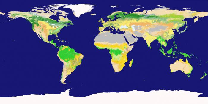
3. Maps are the main tools of a geographer. Maps exist for every type of information related to our planet (and beyond). Geographic map (first g.k. was created in Ancient Greece about 2500 years ago by the scientist Anaximander) - a reduced mathematically defined, generalized, figurative-symbolic image of the Earth’s surface on a plane, showing the location, state and relationships of natural and social phenomena. As the scale decreases, a generalization of the objects plotted on the map and their qualitative and quantitative characteristics occurs.
It helps here cartographic generalization- selection and generalization of objects and phenomena depicted on the map in accordance with the purpose and scale of the map. To depict various objects on the map, a wide variety of cartographic image methods are used: methods of high-quality background, areas, traffic signs, isolines, localized diagrams, icons, and dotted. According to the content of the cards, they are divided into: general geographical And thematic.
The first include topographic maps (M 1:200,000 and larger), survey-topographic (M from 1:200,000 to 1:1,000,000), overview (M smaller than 1:1,000,000). General geographic maps show all elements of topographic content ( settlements, individual buildings, roads, industrial, agricultural and socio-cultural objects, hydrography, relief, vegetation, etc..), i.e. everything that “lies” on the ground and can serve as a guide.
Unlike general geographical maps, thematic maps usually reveal one subject (soil, geological structure, population, vegetation, etc.). All thematic maps are divided into two sections - maps of nature (physiographic, geological, climatic, etc.) and maps of social phenomena (political, population, historical, economic, etc.).
4. Statistical materials are one of the main sources of geographic information. Statistics is a science that studies various phenomena and processes in order to take into account and identify patterns of their development using statistical indicators. In the course of geographical research, statistics solves the following scientific problems: collecting statistical data, processing the collected information, analyzing and interpreting data, presenting statistical information in text, tabular, graphical or cartographic form. Statistical information includes absolute and relative values, as well as various coefficients.
5. Modern sources of geographic information also include aerospace and geoinformation sources: aerial photography, space photography, remote sensing, satellite monitoring. A modern satellite system for high-precision determination of the coordinates of static and moving objects is called GPS. (Global Positional System).
It was developed by the US Department of Defense. The project started in 1978, and the final commissioning of GPS took place in 1995. A fundamentally new approach to working with spatial data is associated with the emergence Geographic Information Systems10 (GIS) is a system of hardware for collecting, storing and processing spatial data. We can say that GIS is a complex computer program. GIS capabilities: quick search for necessary information, GIS cartographic ability, ability to model phenomena on the earth's surface.


